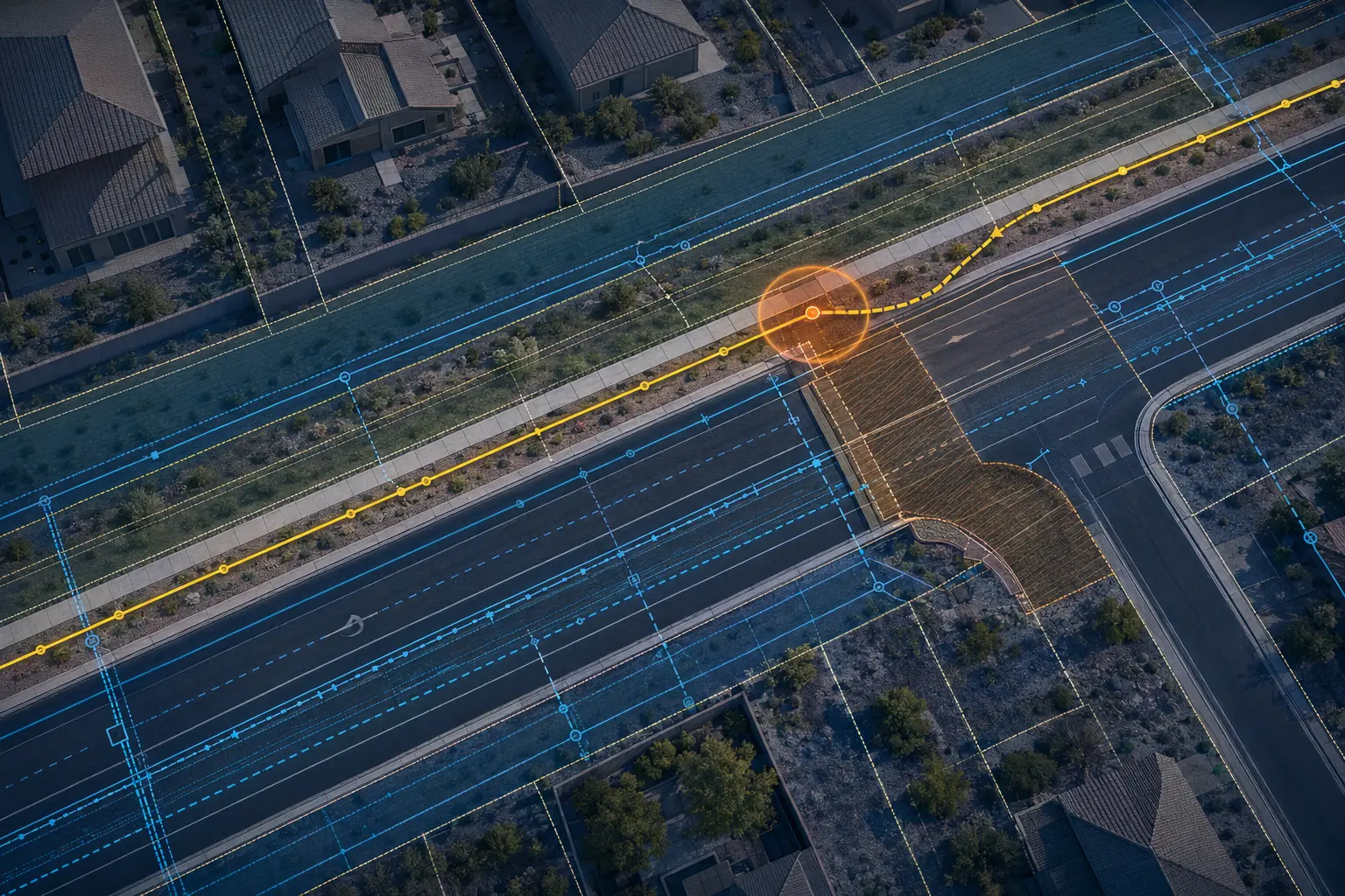
ROW and parcel context
Available right-of-way, parcel, monument, plat, and land-line information organized around the proposed alignment.

ROW · Easement · Utility & CIP Coordination
Research early. Document clearly. Escalate what matters.
Lunex reviews proposed telecom routes against available right-of-way, easement, utility, capital-improvement, parcel, and crossing information. The goal is to identify constraints early enough to adjust the alignment, request better data, or coordinate with the responsible stakeholder before the issue reaches the field.
The Work Behind the Drawings
A route that looks open on an aerial image may overlap a drainage facility, future roadway widening, private property, an existing utility corridor, or a specialty crossing with separate requirements. We bring available records into one coordinated review and document what is known, what conflicts, and what still requires confirmation.
Conflict review is not a substitute for title work, legal interpretation, utility locating, or subsurface investigation. It is an engineering-screening process that helps the project team make better routing and coordination decisions with the information available.
Capabilities
Available right-of-way, parcel, monument, plat, and land-line information organized around the proposed alignment.
Review of available easement exhibits and record information relevant to route access, placement, and coordination.
Comparison of proposed fiber work with available roadway, drainage, water, sewer, streetscape, and other capital-improvement plans.
Early research and exhibit support for highways, railroads, canals, flood-control facilities, bridges, and other controlled crossings.
Typical Deliverables
Scope and formats are tailored to the owner, contractor, jurisdiction, and intended review stage.
How We Work
Confirm the proposed alignment, project limits, planned structures, construction method, and known problem areas.
Collect client data, public GIS, plats, easement exhibits, utility information, CIP plans, and crossing records.
Identify apparent conflicts, data gaps, stakeholder coordination needs, and conditions that require field or legal confirmation.
Document findings, compare alternatives, update the proposed route, and carry open items into permitting or field verification.
A Good Fit For
Scope note: This service is an engineering conflict review, not a legal boundary determination, title opinion, utility locate, or guarantee of subsurface conditions.
Common Questions
It compares a proposed telecom route with available capital-improvement plans—such as roadway, drainage, water, or sewer projects—to identify overlapping work, future conditions, and coordination needs.
We can review and depict available record information for engineering coordination, but legal interpretation and boundary determinations must come from the appropriate legal or licensed surveying professionals.
Controlled crossings often have separate owners, design criteria, application requirements, lead times, and construction restrictions that can materially affect the route and schedule.
Start a Conversation